
California’s largest wildfire of 2021, the Dixie Fire, continues to threaten thousands of homes in Butte, Plumas and Tehama counties.
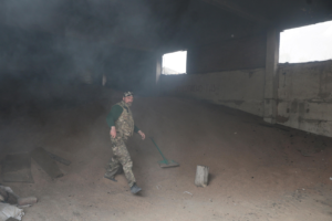
Nearly 5,500 personnel are now battling blaze, which ignited July 13 above the Cresta Dam in Feather River Canyon, Cal Fire’s Butte unit said in a Monday morning incident report.
The Dixie Fire has burned 197,487 acres — more than 300 square miles — and destroyed close to two dozen structures. The state fire agency reported containment at 22% as of Monday morning, up one percentage point from the prior evening. Nearly 11,000 structures are threatened.
Fire authorities have split the Dixie Fire incident into an east zone and a west zone.
Cal Fire reported the east zone, which merged with the Fly Fire, underwent extreme fire behavior Saturday, crossing Highways 70 and 89, and that firefighters “engaged immediately in structure protection” in communities along those two highways. Fire personnel also succeeded in preventing damage to “communications infrastructure” atop Mount Hough.
Officials reported Monday morning that activity slowed some on Sunday, after thick smoke “shaded” the fire, decreasing temperatures.
The west zone of the fire also saw moderate activity, but Cal Fire says it is anticipating a chance of isolated thunderstorms later in the week.
Cal Fire says weather conditions in the forecast this week are expected to lead to “large pyrocumulus clouds” — fire clouds — in both zones of the fire, “increasing the potential for spot fires and rapid fire growth.”
Numerous mandatory evacuation orders remain in place, including the communities of Meadow Valley, Bucks Lake, Prattville, Big Meadows and Lake Almanor West in Plumas County; Butte Meadows, Jonesville, Philbrook and High Lakes in Butte County; and the area of Colby Creek in Tehama County.
Detailed information on evacuation zones spanned seven pages of Cal Fire’s incident report. Many roads are closed, including stretches of Highways 36, 70 and 89.
Officially, the fire’s cause remains under investigation by Cal Fire. But Pacific Gas and Electric Co. in a July 18 filing to state regulators said its equipment may have started the fire.
The Dixie Fire is now the 15th largest wildfire incident in state history, according to Cal Fire archive records. Nine of the 15 have come in the last four years.
Cal Fire is battling the Dixie Fire in unified command with Lassen National Forest.
Tamarack Fire
The U.S. Forest Service in a Monday update said the Tamarack Fire has burned 67,764 acres of timber and chaparral and is 45% contained. Part of the fire has burned into Douglas County, Nevada.
The wildfire ignited by lightning in early July in the Mokelumne Wilderness area and began to grow explosively in mid-July amid heavy winds.
The Alpine County Sheriff’s Office over the weekend lifted several evacuation orders, including for Markleeville, Mesa Vista, Marklee Village, Crystal Springs and some surrounding campgrounds. Mandatory orders remain in place along Blue Lakes Road, the upper and lower Blue Lakes Campgrounds, and the Highway 4 corridor between Highway 89 and Ebbetts Pass.
The Forest Service says fire behavior remains active, and that there was potential for heavy rain and thunderstorms in Monday’s weather forecast.
“Outflow winds from thunderstorms could cause erratic and extreme fire behavior,” authorities wrote in a situation report.