A vast reservoir of ancient water has been found thousands of feet under the ice in western Antarctica, scientists said in a paper published Thursday in the journal Science.
Researchers had long suspected but never before established the existence of such hidden pockets of Antarctic groundwater, which they believe act to lessen friction between ice sheets and underlying bedrock to make the ice more prone to slide from the continent’s interior toward the surrounding ocean.
The first-of-its-kind discovery—made possible by an electromagnetic field-measuring technique that is rarely used in polar environments—shows that there’s far more water under the Antarctic ice than scientists realized. It also adds to a growing body of evidence showing the complex computer models scientists use to calculate Antarctic ice loss and the resulting sea level rise are incomplete.
“Because there were no observations of groundwater prior to our study, it hasn’t really been incorporated in our models of understanding like how ice flows,” said Chloe Gustafson, a postdoctoral researcher at the University of California, San Diego’s Scripps Institution of Oceanography and a co-author of the paper. “I don’t know if you could say we’re underestimating ice loss, but we are missing a process in trying to understand how ice moves off the continent.”
How should governments respond to the discovery of the vast groundwater reservoir in Antarctica? Join the conversation below.
S lawek Tulaczyk, a University of California, Santa Cruz professor of Earth science who wasn’t involved in the new research, called the finding an “intellectual template for understanding the water world beneath the ice” in most of western Antarctica as well as parts of the continent’s eastern region. “It’s kind of satisfying for me,” Dr. Tulaczyk added, “because it more or less kind of confirms what we expected.”
Most of Antarctica is covered with a thick ice sheet, the edges of which periodically slide into the surrounding Southern Ocean to form floating ice shelves. Friction associated with the sliding and heat rising from Earth’s core together form streams of meltwater just below the sheet, lubricating the ice in some areas and facilitating those areas’ glissade off the rock and into the ocean.
Kerry Key, an associate professor of Earth and environmental sciences at Columbia University and another co-author of the paper, likened those mobile areas of ice, known as ice streams, to chilly Slip ’N Slides. “The streams control how fast Antarctica will push ice out into the ocean and cause sea level rise,” he said, adding that they can transport ice at speeds of up to 10 feet a day.
The newly discovered reservoir, a layer of water-saturated sediment nearly 2 kilometers thick in some places, was detected nearly 3,000 feet below the previously characterized Whillans Ice Stream.
“Think of it like a sponge,” Dr. Gustafson said of the sediment layer. “Water can come out of that sponge, and contribute to the Slip ’N Slide flow, or the sponge can soak up water, and take water away from the Slip ’N Slide and make it flow slower.”
For now, the study authors said, the pressure of the ice atop the sediment layer keeps the reservoir water from rising. But as the climate warms and thins the ice, the water could move upward into the ice stream above. That change could speed Antarctic ice loss by increasing the speed of the stream, and transporting the ice it carries more quickly toward the ocean.
The steady flow of ice streams like Whillans makes it hard to study the layers beneath them. Drilling can’t reach deep enough before the ice shifts and potentially shears off the drill bit, according to Dr. Key, and seismic observations and airborne radar commonly used for other Antarctic research have trouble penetrating layers below the ice.
Notes on the News
Keep up with major developments in Ukraine, plus today’s headlines, news in context and good reads, free in your inbox every day.
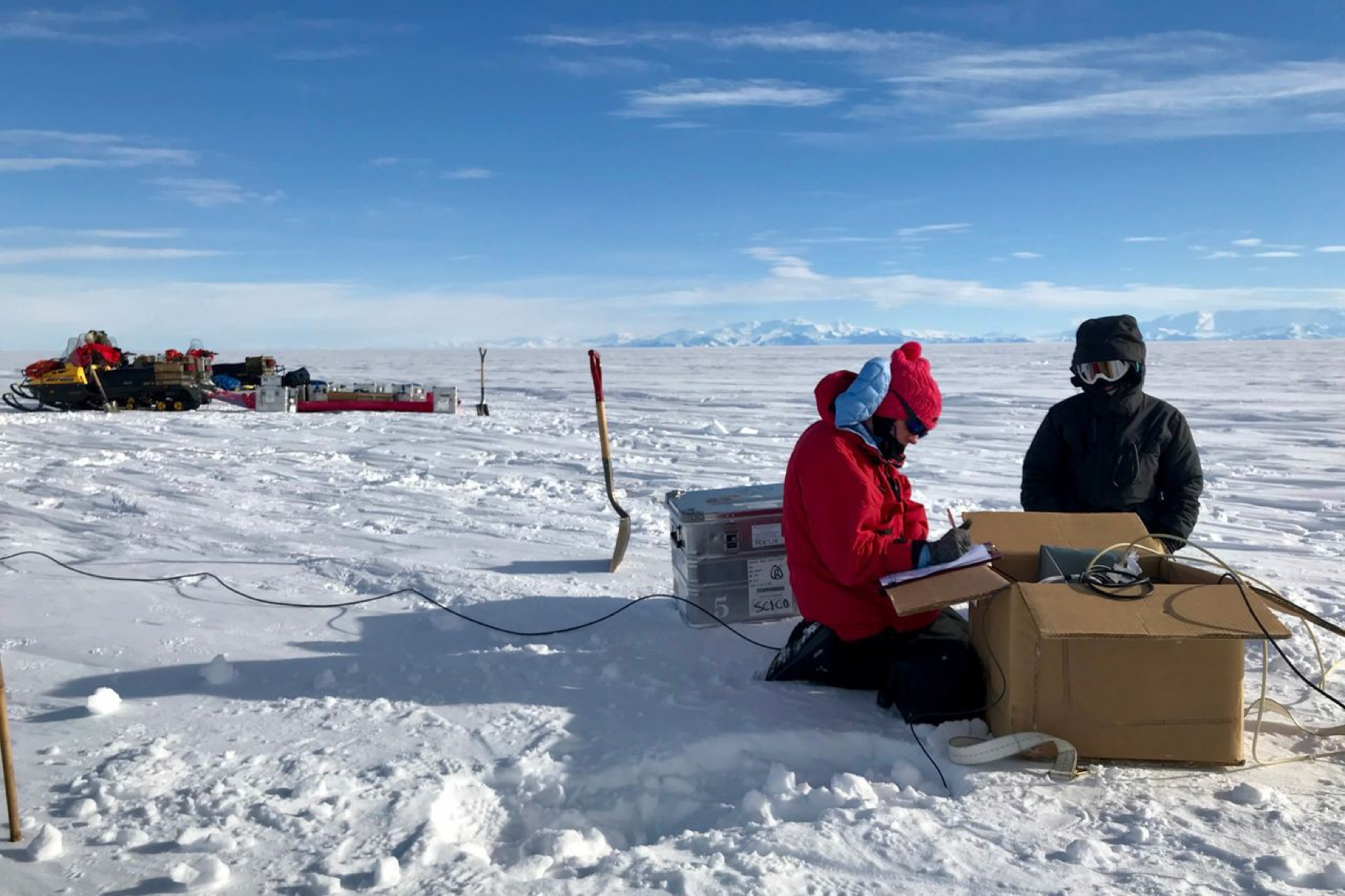
S o the researchers behind the new study turned to magnetotelluric imaging, in which instruments placed in pits on the ice gauge how much of the electromagnetic energy generated in Earth’s atmosphere and surrounding magnetic fields has penetrated the ground below. Saltwater, freshwater, ice and sediment conduct that energy differently, and the instruments can detect these differences to create a sort of map of the subsurface terrain.
Drs. Key and Gustafson and two of their colleagues deployed instruments across the 60-mile-wide ice stream, taking readings at nearly four dozen locations. The readings showed not only the depth and existence of the reservoir but also that it holds a mix of saltwater and freshwater.
Some of the water at the reservoir’s deepest point may have been there since the last time this part of Antarctica was ice-free—and covered in a shallow ocean—around five million years ago, Dr. Key said.
Write to Aylin Woodward at Aylin.Woodward@wsj.com